
STEWARDSHIP STORIES
Increasing Wildfire Resilience
The Boise Front
Drive north out of urban Boise on Idaho 21 and you quickly leave the city behind. The landscape opens into grassy canyon walls and open hillsides framed by reservoirs below and distant mountains on the horizon. However, scattered among this dry country are homes: a mansion perched on the rim, a cabin down by the creek, and a few new spec houses in the corner of a hayfield. Indeed, if you drive up a side canyon, you might find hundreds of structures evenly placed among the brush and timber.
The Boise Front is a textbook example of what land managers and fire professionals call the wildland-urban interface. This combination of scattered, expanding development and fire-adapted forest and shrub steppe makes for a dangerous combination. In fact, the United States Forest Service considers southwest Idaho as one of the most at-risk places in the country for catastrophic wildfire and the threat it poses to life and property. Unfortunately, most Americans have learned about this dynamic in recent years as high-profile fires raged through communities in California, Colorado, and Hawaii.
With the known risks and all-too-visible tragedies in similar landscapes, what is being done to reduce the likelihood of such disasters in southwest Idaho? One strategy is to reduce the fuel load in the surrounding wildlands. Younger trees and brush growing in thickets support fires and can act as “ladder fuels,” allowing a blaze to jump into the canopy. This, in turn, fuels hotter, more intense fires.
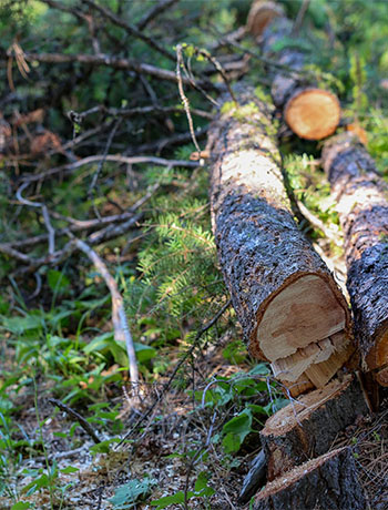
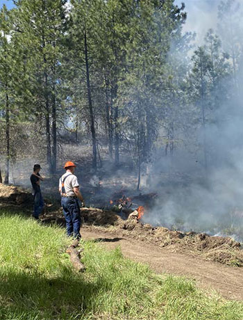
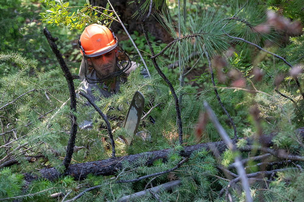
Thinning of forests can be accomplished by cutting down and removing young trees and brush. The resulting material is either piled up and burned in the winter, ground up into fine mulch, or removed to be used as firewood. Where possible, trees can also be logged for use in sawmills, which helps to pay for fire mitigation projects. Another strategy for reducing fuels is, paradoxically, fire itself. Intentionally starting small fires during times of the year when it is easy to control. These prescribed fires mimic the historic regime of frequent, low-intensity burns, reducing fuel loads and rejuvenating the soil.
Federal and state agencies, counties, non-profits, and private landowners are working to reduce the impacts of catastrophic fires in the region. To date, this work has focused on thinning forests managed by the United States Forest Service (USFS) and private landowners in and around unincorporated communities along the Highway 21 corridor in Boise County.
Boise County, the USFS, the Idaho Department of Lands (IDL), the National Forest Foundation (NFF), and landowners have collaborated to conduct fuels reduction work in the Clear Creek Community. To the northeast of the subdivision, the NFF leveraged USFS regulatory support, technical support, and funding to plan and contract 700 acres of noncommercial thinning. Meanwhile, Boise County and IDL worked with willing landowners to channel state and federal funds into conducting fuels work on adjacent private lands. The result is the beginning of a coherent response to the threat of wildfire posed to the Clear Creek community and a model for future collaborative efforts.
Such cooperation helped initiate the Southwest Idaho All-Lands Partnership. The partnership consists of land management agencies, businesses, nonprofits, and community members working together to pool funding and expertise to collaboratively plan and implement landscape-scale wildfire mitigation work across private and public lands. The goal is to scale up efforts like those around Clear Creek in order to meaningfully affect fire behavior across southwest Idaho, helping to protect life and property in this dry region.
Project Goals
- Forest and Watershed Health: Improving overall forest resiliency and reducing the
- Community Safety: Reducing wildfire risks to safeguard communities
- Public Expectation: Meeting the expectations of the American public, who look to
- Collective Commitment: Sharing a commitment among group members to work
Project Resources
The Southwest Idaho All-Lands Partnership is a response to the challenges presented by modern wildfire.
Landowner Stewardship


According to private land manager Kari Greer, when it comes to facing the future of wildfire, it starts in your own backyard. In the spring of 2024, Kari got together friends, family, and neighbors to conduct a prescribed burn on her family’s ranch in Garden Valley, Idaho – successfully burning 30 acres over the course of four days. When asked, “why?” she says:
“If you have forested land that you own and you see that it needs help, you need to be the one that does it. If you know you could do something, you probably should.”
Surrounded by other private holdings, Bureau of Reclamation and Boise National Forest lands, Greer’s ranch is positioned in the wildland-urban interface: the zone of transition between unoccupied, undeveloped land and human development. This interface can be especially hazardous when a wildfire comes through if either the human-developed land or the undeveloped land have a build up of vegetation that hasn’t been actively managed by fire or other mechanical methods, as the vegetation accumulation can be highly combustible and lead to unstoppable wildfires. This is exactly why Greer decided to take action on her land and be proactive rather than reactive.
She combined several land treatments – prescribed fire, vegetation thinning, targeted grazing, and selective logging – and the process wasn’t easy or cheap. The first day of the burn, they faced unpredictable winds that made it challenging to progress as quickly as she would have liked. Most of the people helping out had little or no experience with fire, but all were willing to learn and put in the time to help out their neighbor and the land. The vital leadership positions needed for a burn like this Greer hired out, paid for through revenue from selectively logging the property a few years ago. She says it was all worth it.
Prescribed burns like Greer’s reduce brushy ground vegetation and stimulate the growth of grasses and forbs, transitioning the forest understory to a lower height and lessening the probability that a fire could pass from the understory to the tree canopies. The mountains around Garden Valley are a good example of what happens when a fire does just that – a wildfire in the 1960s came through, traveling through the tree canopies. Most of the trees never came back, and now the mountains and hills are mostly brush. After this prescribed burn and other vegetation reduction work on her land, Greer is confident that if, and when, another big wildfire were to come through, they would have a much better chance at saving the ranch than if they had done nothing.
The problem of vegetation accumulation doesn’t just exist on Greer’s land, or even just on private lands. All lands in southwest Idaho, across all boundaries, face the threat of hazardous vegetation buildup at the wildland-urban interface. In fact, southwest Idaho was identified as one of the most at-risk regions in the country from the threat of wildfire to life and property. This is why the Southwest Idaho All-Lands Partnership has come together: to address this threat and develop ways to reduce it across boundaries and ownerships. We aim to provide interested and willing private landowners – like Greer – with easily accessible tools, funding support, and processes to reduce vegetation buildup on their property. By working together across jurisdictions, we can reduce wildfire risk across the whole map and restore southwest Idaho as a landscape resilient to fire.
Greer knows what’s at stake, and it’s not just her family’s ranch. It’s her neighbors, her community, her home state. She has plans to continue this work in the future, and the All-Lands Partnership wants to help.
Project Goals
- Forest and Watershed Health: Improving overall forest resiliency and reducing the
- Community Safety: Reducing wildfire risks to safeguard communities
- Public Expectation: Meeting the expectations of the American public, who look to
- Collective Commitment: Sharing a commitment among group members to work
Project Resources
The Southwest Idaho All-Lands Partnership is a response to the challenges presented by modern wildfire.
Bear Basin
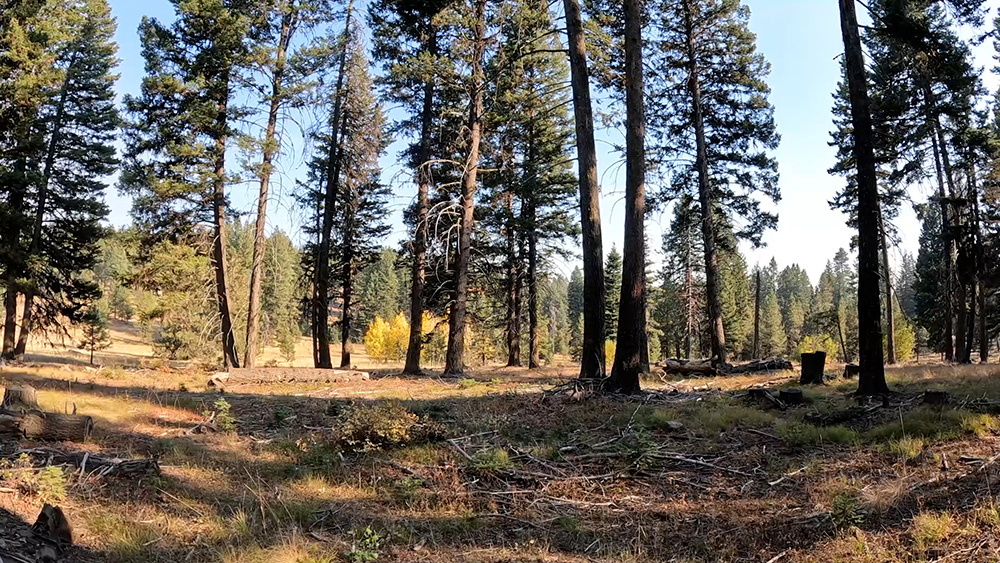
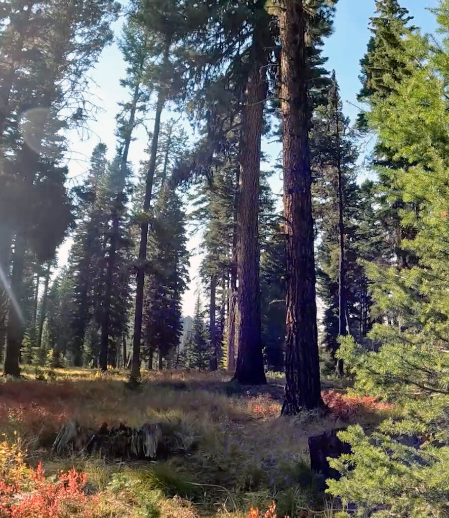
To residents and visitors of McCall, Idaho, Bear Basin of the Payette National Forest is a staple recreation hub where the outdoor enthusiast can hike, ride horseback, mountain bike, run, Nordic ski, snowshoe, collect wild foods, and enjoy all four seasons in beautiful west-central Idaho. Today, a visitor can enjoy lush meadows, abundant wildflowers, wildlife sightings, large trees, and – if they look closely – signs of active forest management. Recently charred tree trunks are commonplace, and the reason a hiker can see a biker coming from around the corner of the trail is that the lower limbs on many trees have been removed. For those who have been around the area longer than a decade, they know it hasn’t always looked like this. A visitor to Bear Basin in 2012 would see thick, dark forest with so many young trees the large ones would be obscured. But, travel even further back in time to the 1980s, and Bear Basin would resemble something much more similar to what it is today: old-growth ponderosa pine with grass covering the forest floor. Over those intervening years, lack of regular forest disturbance from fire allowed many young trees to establish under the old-growth pines, creating a dense thicket of vegetation and shrinking large meadows to a fraction of their former size. This lack of disturbance affected both public and private lands around Bear Basin – the dense vegetation creating a high potential for uncharacteristically severe or large wildfires. In the early 2000s, there was an obvious need for restoration.
By the mid-2000s, the situation was dire. Bear Basin’s proximity to McCall means a severe wildfire here would surely impact the town and its residents. With the need to both restore the forest to a healthy state and reduce the hazard of extreme fire behavior, the Brundage Wildland Urban Interface/Bear Basin Forest Restoration Project was born. The Forest Service initially proposed the project in 2009, and by 2012 was implementing vegetation reduction work consisting of commercial logging, small-tree thinning, and prescribed fire where appropriate. The spectrum of forest treatments took the next ten years and counting to work on, with the first round of prescribed burning taking place in 2021. Because Bear Basin is such a large area, it is divided into smaller units and land managers rotate through burning different units each year, allowing for more targeted, specific effects and for land managers to accomplish more area with fewer people over time. In order to maintain this area in its current state, prescribed fire must be used at regular intervals on each piece of treated land. Otherwise, it will return to a dense thicket of hazardous vegetation accumulation. Payette National Forest officials noted that public support for prescribed burning 15 years ago is not what it is today. Initially, public pushback for this work seemed to threaten land managers’ ability to restore the forest to a healthy state. Ultimately, it was the private landowners who live in the Bear Basin area who came together in support of this project that got it off the ground. Locals consider Bear Basin like their backyard, and if the backyard burns in an intense wildfire, there is a good chance the house might go with it.
The state of the Bear Basin area today is the result of over a decade of cross-boundary, collaborative work between the US Forest Service, private landowners, Valley County, and Idaho Department of Lands. Early on in the planning process, Forest Service officials recognized that a project of this caliber would need to involve all land ownerships in the area, not just federal. The problem of overly dense, hazardous vegetation buildup did not stop at any one boundary; it affected everyone. Notably, Valley County officials worked with Stephanie Nelson of Wildfire Prevention Associates to contact and help get landowners on board with doing this work on their lands, too. As early as 2007, she was working with landowners in the Bear Basin area to implement county grants for small-tree thinning on their property, and has since worked with around 100 nearby landowners to reduce over 400 acres of hazardous vegetation buildup on their land. According to Nelson, when it comes to populated areas like McCall, the more active landowners are in signing on for vegetation reduction, the more effective suppression efforts can be when a fire starts in the area. She cites the trust established with them over the years and the ability to educate landowners about the benefits of this work as major contributions to the ongoing success of this project. Even high-ranking officials from the nation’s capitol are taking notice of this project. Forest Service Chief Randy Moore commented after his recent visit:
“You are proving it can be done! The challenges we face today were years in the making. Not just recent years, but over decades in which national forests were undermanaged. The fuels reduction work and wildfire risk mitigation I have seen today proves we can accomplish the task at hand. If anyone questions the success of fuels reduction, just show them this place!”
Bear Basin is far from finished. The Forest Service will have to do maintenance burning in different portions of it every year. Some landowners have held out on removing vegetation, and the Idaho Department of Lands has planned work for the next several years in the area. But every acre treated, every acre with vegetation thinned and reduced, is an acre that contributes to the solution and not the problem. Resilience to wildfire is a goal for all of us, across all boundaries and land ownerships. That’s why the Southwest Idaho All-Lands Partnership started: to bring people together to help our community and reduce the risk of severe wildfires affecting our home. If you are a landowner or manager and want to be a part of the solution, see our Landowner Resources page for more information.
Project Goals
- Forest and Watershed Health: Improving overall forest resiliency and reducing the
- Community Safety: Reducing wildfire risks to safeguard communities
- Public Expectation: Meeting the expectations of the American public, who look to
- Collective Commitment: Sharing a commitment among group members to work
Project Resources
The Southwest Idaho All-Lands Partnership is a response to the challenges presented by modern wildfire.